Learn more at – VoicesForPublicTransit.org
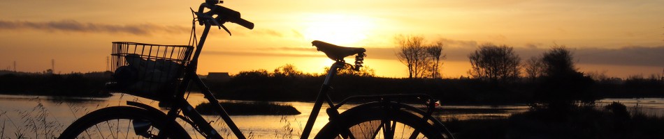
Learn more at – VoicesForPublicTransit.org
![]()
Have you visited the California 2040 website? Would you like to participate in giving your input, regarding the plans? Whatever your mode choice of transportation, this is the place to speak up about California’s future in transportation infrastructure. What is important to you in our California transportation infrastructure?
Here you will find a link to a quick fact sheet, for California 2040 –
CTP-FactSheetEnglish_NewLogo_022315
Also be sure to visit the full 2040 website
The public comment period is now open to submit your feedback ! You have until April 17, 2015 to submit your comments.
If you live in California, or care about California transportation infrastructure. Please participate in giving your feedback !
FOR IMMEDIATE RELEASE
Report Highlights Caltrans’ Commitment to Improve Travel for Non-Motorized Users
SACRAMENTO – Caltrans’ jump into the nation’s top ten bicycle-friendly states and the creation of the nation’s largest active transportation program are just a few of achievements highlighted in Caltrans’ annual Non-Motorized Transportation Facilities Report.
The report is an in-depth look at Caltrans’ successes that emphasize the department’s mission to provide a safe, sustainable, integrated and efficient transportation system to enhance California’s economy and livability.
“California has always been a transportation leader, and this report reinforces that hard-earned reputation,” said Caltrans Director Malcolm Dougherty. “Transportation is a vital part of our daily lives, and increasing the diversity of travel options is something the public wants. We are committed to making walking and biking safer.”
The report provides an overview on the state’s Active Transportation Program (ATP), the largest of its kind in the nation. In its first call for projects in May 2014, Caltrans received 771 project applications requesting more than a billion dollars. The California Transportation Commission has adopted the first program of projects for the ATP, which includes 265 projects using $368 million in ATP funds. Of this amount, $311 million is dedicated to 220 projects that benefit disadvantaged communities.
The report also highlights program activities and completed projects, as well as other state and federal partnering programs to establish and improve bicycle and pedestrian facilities. Among the completed projects highlighted in the report is the Oak Manor Trail in the city of Ukiah. The project improved cross-town connection to schools, shopping centers and employments centers. It also gave pedestrians and cyclists a new off-street travel alternative. Southern California saw its first “Bicycle Boulevard” in the city of Pasadena—an area with a high concentration of cyclists. The project improved bicycle safety and advanced the vision of commuting in Pasadena without a car.
“Caltrans’ has historically been known as a highways agency, but we are shifting our focus to creating a California transportation system that links communities and is safe for all travelers, including those who choose to travel by biking and walking,” said Dougherty. “We couldn’t accomplish this without our partners at all levels, from the federal government to grassroots organizations and the public.”
The state’s jump in 2014 from 19th to 9th in the nation in The League of American Bicyclists annual report is due to notable progress in legislation, funding and policy that will make it easier to build bike lanes and mandate drivers to give cyclists three-feet of space when they pass.
Also, as part of its effort to streamline construction of multimodal local streets and roads, in April 2014, Caltrans became the third state to endorse National Association of City Transportation Officials guidelines that include innovations such as buffered bike lanes and improved pedestrian walkways.
Caltrans also released its 2010–12 California Household Travel Survey Final Report that showed residents used walking, biking, transit and other non-motorized sources for 23 percent of trips. That was more than double the amount in the 2000 survey. This underscores the rising demand for non-motorized transportation.
You can read the full report at http://www.dot.ca.gov/docs/Non-Motorized_Transportation_Facilities_Report_FY_2013-14.pdf.
You can read more about The League of American Bicyclists report cards at: http://bikeleague.org/content/report-cards.
Anyone whom lives in the Humboldt Bay region will know the Bay Trail is a high priority project, and Eureka is moving full force on completing the waterfront trail. In fact soon to be constructed non-motorized projects are happening all around us! Though our friends to the north already have a coastal trail in Crescent City. A new portion of the Crescent City coastal trail has been getting discussion recently in the Humboldt Bay region. Perhaps you listen to the Happy Trails show on KHUM radio? Well readers here requested a closer look at the new trail, and you will get that in this article, plus more. In the summer of 2015 the trail will be constructed to extend further south to South Beach.
(Click on red markers on the map for short notes about the trail location tags)
This was just a wonderful visit, and I intend to as usual share some great images with you! I drove up from Arcata, then parked at the Citizens Dock Rd. boat basin, next to the harbor. At this point I rode my bicycle to enjoy the views along the trail, and around the harbor district. If you are in the Humboldt Bay area, or passing through the Crescent City area, it is well worth a coastal trail visit!
Things to do – Lots of things to do along the coastal trail in Crescent City :
* Restaurants – seafood establishments surround the Harbor district. Both along Citizens Dock Rd. and Anchor Way. Also just across the 101 by the new section of trail, you have various food choices as well. As you go further north on the trail, signs exist to point you towards shops in town.
* Along the trail is the local chamber of commerce (always a great resource for local information), Community pool, a public library, childrens playgrounds, waterfront parks, plenty of places to put your feet in the sand or the Ocean, disc golf, B Street Pier, a Jetty, benches, picnic tables, South beach is easy to access by the harbor district(watch surfers at South Beach), and just in general unlimited enjoyment! You’ll be sure to find more as you walk/bike along the path. You can also find a skate park only a few blocks away from the trail.
From Citizens Dock Rd to Battery Point lighthouse the paved multi user trail is about 1.5 miles long (one way). So it is very enjoyable for both walks, and easy bicycle rides alike.
Harbor/boat basin images –
Learn about the Harbor district history here. In recent years the harbor was reconstructed due to being totally destroyed by a tsunami in 2011. Let’s look at some harbor, and boat basin images :

boat basin
Cool bicycle racks can be found around the harbor!

Octopus bicycle rack
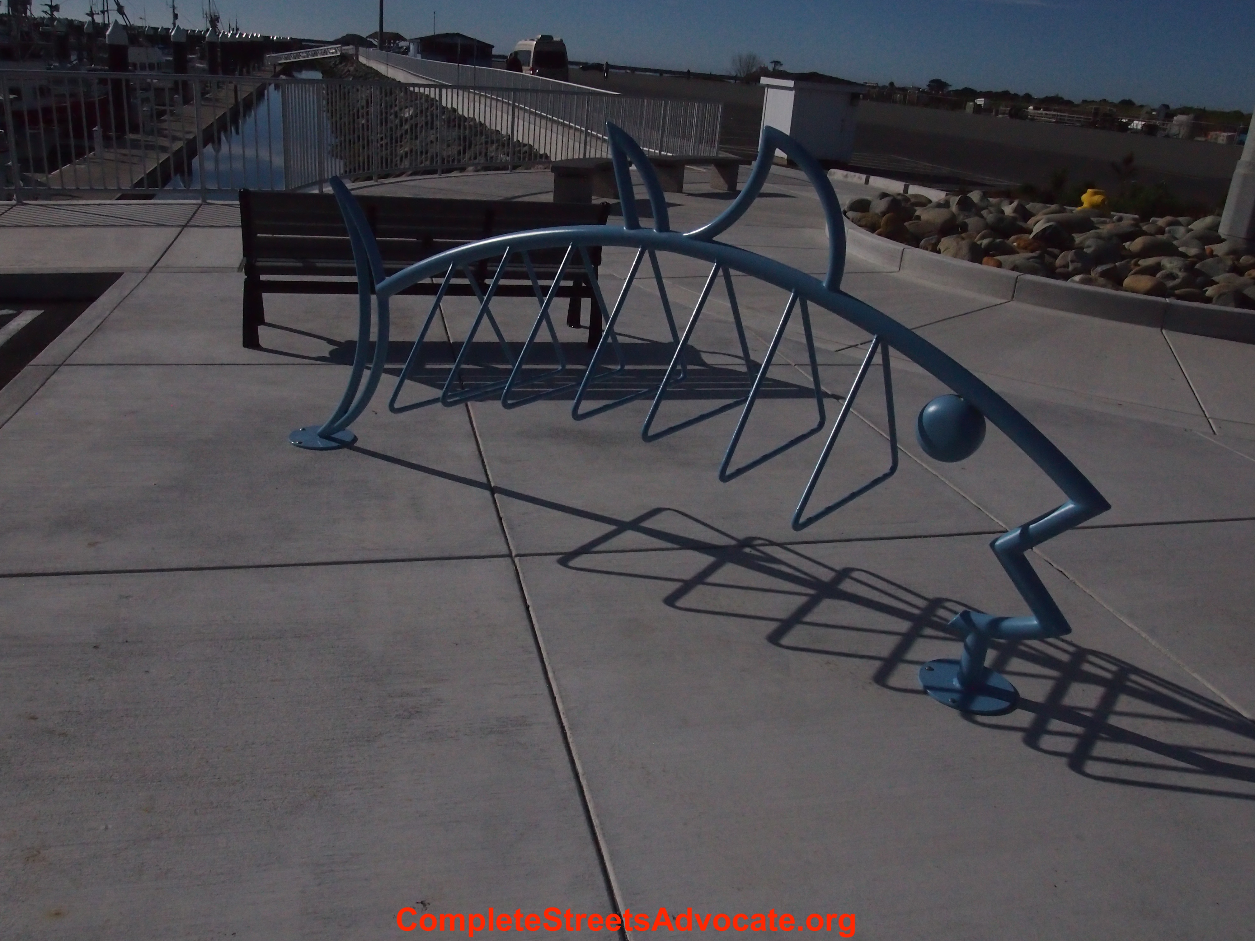
Tuna bicycle rack
Sheltered areas can be found during foul weather.

Inviting art to make you smile !


I loved viewing the seals, and sea lions around the Harbor. Learn more about that here, on good viewing sites.


Find picnic tables near auto parking at the boat basin.

Signs of partnerships –

I enjoyed the harbor before getting on the trail. Be sure to ride around Citizens Dock Rd. and Anchor Way area. Lots of enjoyable things to see!
In this image we are looking south from Anchor Way to the South Beach area –

Trail images –
The new portion of the trail can be found on Citizens Dock Rd. by the boat basin parking lot.


At the north end of the boat basin the trail heads towards Sunset Cr.

I like the lights along this portion of the trail !

Sunset Cr. access point –

Now just turn onto Sunset Cr. a quiet/short road, that will connect with more of the Coastal Trail.
Heading further north along the trail –


Along the Beachfront Park area –

Howe Drive Park –

B Street Pier –


The end of the Trail by Battery Point lighthouse –


Accessing the lighthouse is tidal dependant. So if you want to enjoy the lighthouse up close, be sure to visit during low tide!
Looking south from B Street. The trail would be to the left of the image, and the harbor can be seen in the distance.

This was a wonderful visit, on a beautiful sunny day! I would really encourage folks to take full advantage of the Crescent City portion of the Coastal Trail! A walk/bicycle ride will be a slice of heaven. Multiple places are available for auto parking if you are traveling from outside of Crescent City. So you have plenty of options on your starting point.
I’m sure Crescent City would love to have you visit. Be sure to enjoy a meal, or check out the nearby shops, that can be found very close to the trail corridor!
The Del Norte County, California Coast, in Crescent City is a great place to visit!
Some folks have asked if I would share images of the new School road project, and curious of what my observations were of the project.
On the eastern end from Central Ave to Washington blvd, School road had no changes. You have a standard bicycle lane on this section.
The western end from Rogers market by Fischer road down to the end of School road by Ocean Drive. This section of road does not have any existing bicycle lane, however the School Road Trail does exist, as it has for some time. As seen in the image below.

photo credit – Chris Butner/completestreetsadvocate.org
If you go to the very western end of the School road trail. You will find a public access trail that will lead you to the Mad River. Check out this area if you have not already! No bicycle rack is at the end of the trail, but some street signs are nearby to lock your bicycle to a secure pole. I would love to see the county install a bicycle rack at the trailhead! This image below shows the beginning of trail with the river in the background.

photo credit – Chris Butner/completestreetsadvocate.org
Looking east up the School road trail, seen below. Check out the short pathway, if you have not already. A great side trip if you are already on the Hammond trail!

photo credit – Chris Butner/completestreetsadvocate.org
Another section of School road that had no changes during the improvement project was the highway 101 overpass area. This would be within the State right-of-way, so not within Humboldt County public right-of-way. The School road project was completed within the Humboldt County right-of-way.
Washington Ave to Windsor Ave –
In general the road was widened, and a added median in the center of roadway. This section did get a new bicycle lane which it did not have previously. I did find this section to be more enjoyable, as compared to the previous design, from a bicyclists standpoint. This area also received pedestrian improvements with new sidewalks. This area also received some utility work improvements.
Here is a picture of the new bicycle lane below going west towards the highway 101. As you can see this area has no shoulder automobile parking going west. With the “no parking in bike lane” sign. I would like to see the County paint the curb a red color, to further highlight no parking. Some areas in the westerly direction towards town have street-side automobile parking next to the bike lane.

photo credit – Chris Butner/completestreetsadvocate.org
A round-about is a significant new feature along the street-scape, located just west of the highway 101. Bicycle lanes on School road are only on the east side of the round-about, in both directions.
Below is an image of the round-about looking west –

photo credit – Chris Butner/completestreetsadvocate.org
On the perimeter of the round-about the curbs have rounded edges to allow for larger size vehicles etc. –

photo credit – Chris Butner/completestreetsadvocate.org
Typically, bicycle travel in a round-about it is best to just take the lane. This allows you to not get squeezed by motor vehicles. I always take the lane when I bicycle through a round-about. Although I had a new experience with this on the school road round-about traveling in the easterly direction up the hill. Since the curb design was so rounded, allowing easy access to the sidewalk. I found it much more natural to just roll up on the sidewalk to follow the round-about uphill. Since my uphill speed was so slow, it just seemed more comfortable to remove myself from the shared traffic lane. Going down hill taking the lane was comfortable, since my speed was more with the flow of auto traffic.
To the west of the round-about is a shared roadway. No bicycle lane exists, the County decided to use sharrows. I assume the right-of-way through this section was limited. So they could not widen the road to include a bicycle lane. Learn more here about how sharrows are defined.
Image below is looking west on the sharrow –

photo credit – Chris Butner/completestreetsadvocate.org
Sharrow looking east –

photo credit – Chris Butner/completestreetsadvocate.org
In Europe such as places like Amsterdam they don’t use the term sharrow. It’s just a shared, or mixed use roadway, with no special signage or road markings. However what I really like is that any shared road always has a reduced speed limit, so essentially automobiles/bicycles are all traveling at the same speed (usually around 20 mph). I find the European mobility mindset to make a lot of sense! I’m saddened that most US road engineers don’t incorporate these ideas into US shared roadways, such as sharrows. These shared roadways would be much more safe if we could reduce the speed limit, just a little! This is what it will take for more families to ride bicycles, kids riding/walking to school, and in general getting more citizens to feel safe with non-motorized travel.
In general more crosswalks have been incorporated into School road, a wonderful improvement for pedestrians. Below is just one example –

photo credit – Chris Butner/completestreetsadvocate.org
At the intersection of School road and Fischer, below. You can see a separated sidewalk on the right side of image. At the top of that is the Hammond Trail. So this is a nice improvement for trail users to cross School road. On the left of this image is the School Road Trail, discussed earlier in this article. I really like the improvements at this intersection!

photo credit – Chris Butner/completestreetsadvocate.org
Here is an alternate view below, looking at Fischer from the separated sidewalk. Continue south on the Hammond Trail, or take a side trip on the School Road Trail!

photo credit – Chris Butner/completestreetsadvocate.org
This concludes a closer look at the new School Road in Mckinleyville, CA. I hope you have enjoyed the images I have shared with you, and some of my thoughts on the new roadway.
Happy new year to all of you! We all deserve safe mobility, no matter what our mode of transportation.
————————-
Other articles you may enjoy reading –
We are now on instagram! Some readers have asked me if I will ever do this. I’ve decided to give it a try. Consider following me as instagram user – complete.street.advocate
This will be an outlet for me to share simple images of my area, and outside of Humboldt Bay. To tell a social story if you will, of things on the streets, transportation, etc. I believe this will be very fun, and effective!
Instagram is most powerful on your mobile device, and I hope you will join us. You will also see recent instagram images on my website sidebar. To get things started I will share some images I have taken in recent times, but as we move forward look for new images not included in website articles.
Thank you to all those who visit me, and share my stories.
In this post we’ll discuss briefly some CalTrans right of way examples here in District 1.
I wanted to highlight if you see something in the CalTrans right of way that needs maintenance upkeep. You can find a tool online to submit requests to CalTrans.
CalTrans in Arcata –
In these images below I can show you an example of a request I submitted, and the results of the request. I want to show you that you can be empowered as a citizen to help improve the infrastructure, by submitting request, that may otherwise get overlooked.
The images below are in Arcata along Somoa blvd. The first image is the before shot, than the after shot.

photo credit – Chris Butner/completestreetsadvocate.org

photo credit – Chris Butner/completestreetsadvocate.org
As you can see the results are huge for pedestrian infrastructure. Typically what happens in a service request submission – you will receive an automated response after submitting the request, then at a later time you get a personal response from a local CalTrans employee(to confirm your request was received), Usually you will also receive an email once the requested work was completed!
So be aware of the online tool to submit service requests, and don’t be afraid to use it. As a citizen you do have the power to help keep our streets safe! If you are not sure what right of way a particular street is in, consider calling your local city hall to help get answers to your questions about a street.
Let’s take a quick look at CalTrans in Trinidad –
This is a different type of example on how you can enhance a street users experience. In more recent time CalTrans did bridge work, this is the 101 overpass at Main street in Trinidad.

photo credit – CalTrans district 1 Facebook page.

photo credit – Chris Butner/completestreetsadvocate.org
It’s wonderful to see this type of art up in Trinidad along our roadway! It certainly adds character to this small beautiful coastal community.
————————-
This article shares two examples on how you can enhance the street users experience. Examples of project upgrades, as well as user maintenance service requests.
At complete streets advocate we hope you have enjoyed these images, and find the information helpful.

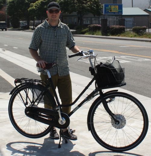
Chris with his dutch bicycle
